My Blog
Welcome to my blog! Here you will find a collection of projects that I have worked on. Take a moment to explore them and enjoy!
Introducing FoodSight: Bridging the Gap in Ranching Data Accessibility
In this post, I want to present to you the latest project I have been involved in. FoodSight, an ambitious platform aiming to integrate crucial ranching data....
Read more →
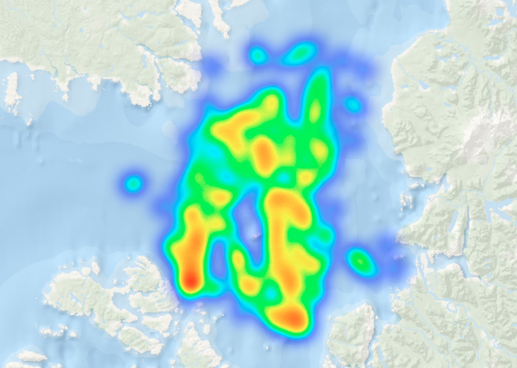
Vessel detection in SAR images: Potential for improved fisheries management
In this post I show how the derived data from a vessel detection model can be used to monitor fishing activities...
Read more →
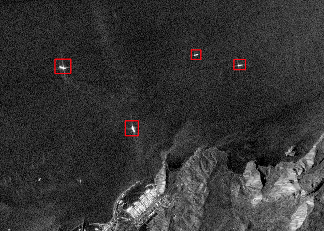
Vessel Detection with AI: SAR Imagery and Faster R-CNN Models
Using computer vision techniques in combination with Synthetic Aperture Radar (SAR) images, I created a model capable of detecting ships in open ocean and coastal areas...
Read more →

R Shiny interactive tours using Conductor
Check out the user-friendly guide I added to the Gaviota Coast Interactive Planner created for The Nature Conservancy. It is a great example if you are interested in implementing a guided tour in your own app...
Read more →
Creating an Interactive Planner using R Shiny
As part of my Master's project for The Nature Conservancy, I have been developing the Gaviota Region Interactive Planner, an R Shiny app designed to visualize and evaluate spatial environmental data in the Santa Barbara County region...
Read more →
Extracting GFW's Fishing Effort Data using Earth Engine Python API
In this post we will dive into the world of Google Earth Engine (GEE) datasets and how to access them using the Python API. Our focus will be on a dataset from Global Fishing Watch (GFW) which provides daily fishing effort as inferred fishing hours. We will take you through the steps of how to read in the dataset, visualize the data, and extract...
Read more →